LT, Smèlyne Farm
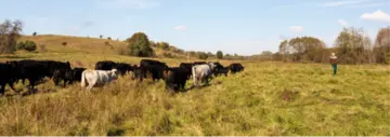
© Žymantas Morkvėnas
Map
Privacy notice for OpenStreetMap
When using the interactive OpenStreetMap, personal data, in particular your IP address, is transmitted to the OpenStreetMap server. This is done in order to display the map data and provide the service.
LT, Smèlyne Farm
Best practice profile
Good practice
Justina and Laurynas Kaučikai, Smėlyne farm
Country
Lithuania
Biogeographical Region
Boreal
Region
Šiauliai municipality district
Landscape/ Eco system type / protected area
Grasslands and wetlands in a hilly landscape and a river valley. The whole area is part of Kurtuvėnai Regional Park, partly in the Natura 2000 network.
Agriculture Use
- 60 ha of pastures, partly wetlands
- Mainly cattle farming
- In total, 75 cattle, including calves, of which 30 are Angus cattle, 2 Dexter, 2 Lithuanian light grey cattle. The remaining are mixed breeds between the mentioned cattle