DE, Labertal
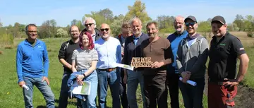
© Bernd Bluemlein
Map
Privacy notice for OpenStreetMap
When using the interactive OpenStreetMap, personal data, in particular your IP address, is transmitted to the OpenStreetMap server. This is done in order to display the map data and provide the service.
DE, Labertal
Best practice profile
Good practice
Habitat Network 'Grosse Labe River
Country
Germany
Biogeographical Region
Continental
Region
Bavaria
Landscape/ Eco system type / protected area
A river floodplain dominated by grassland, with wide floodplains and remnants of riparian woodland and fens
Agriculture Use
- Floodplain: mainly nature conservation grassland and farmed grassland, in parts grazed with livestock
- Adjacent farmland in the hilly countryside: fertile arable land intensive farming & special crops (e.g. asparagus)