
IT, Una Garlanda Farm
Map
Privacy notice for OpenStreetMap
When using the interactive OpenStreetMap, personal data, in particular your IP address, is transmitted to the OpenStreetMap server. This is done in order to display the map data and provide the service.
IT, Una Garlanda Farm
Best practice profile
Good practice
Una Garlanda Farm
Country
Italy
Biogeographical Region
Continental
Region
Po Plain district
Landscape/ Eco system type / protected area
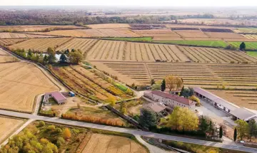
‘Una Garlanda Farm’ is located in western ‘Po Plain’ (Piedmont region), an alluvial district dominated by intensive agricultural systems, mainly related to livestock breeding and rice production. The ‘Po Plain’ landscape is rural, with predominantly annual crops and poplar groves. Almost no landscape features and natural habitats are preserved, except for the main river ecological corridors.
Agriculture Use
Rice fields in rotation with millet, black-eyed bean, oat, rye, grassland, soybean, wheat, pea and winter multi-species cover crops.