
CR, Cooperative Eko-Gajna
Map
Privacy notice for OpenStreetMap
When using the interactive OpenStreetMap, personal data, in particular your IP address, is transmitted to the OpenStreetMap server. This is done in order to display the map data and provide the service.
CR, Cooperative Eko-Gajna
Best practice profile
Good practice
Cooperative Eko-Gajna
Country
Croatia
Biogeographical Region
Continental
Region
Slavonia, Brod-Posavina County, area of special state concern
Landscape/ Eco system type / protected area
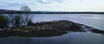
Significant landscape (approx. cat V IUCN) from 1990 and part of the EU ecological network (Natura 2000) –Special Areas of Conservation (SACs) and Special Protection Areas (SPAs), High Nature Value (HNV) Grassland since 2019. Seasonally flooded by ‘Sava River’.
Agriculture Use
- 300 ha, of which 250 ha of naturally flooded area are reported in the ‘Land Parcel Identification System’ (LPIS) as pasture since 2015, and as a HNV Grassland since 2019
- 12 herds (cattle, horses), max. 1 cattle per ha + geese